
What I Learned From My First Hike in New Zealand
Did you know that Illinois is the second flattest state in the U.S. after Florida? Chicago, where I reside, also sits at an average elevation of 579–595 feet (176–181 meters) above sea level. I share these facts to set the scene for my first hike on my New Zealand trip.
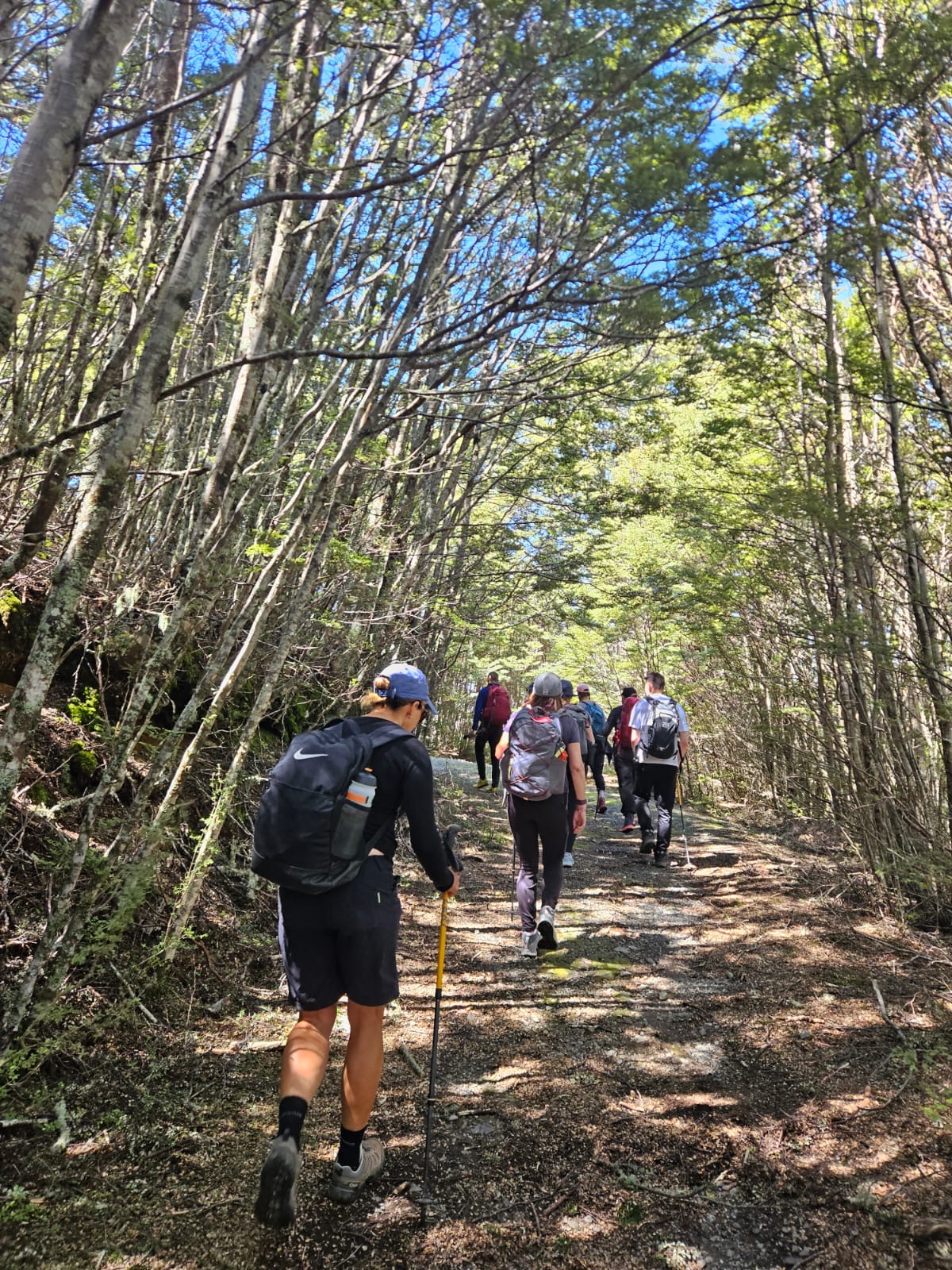
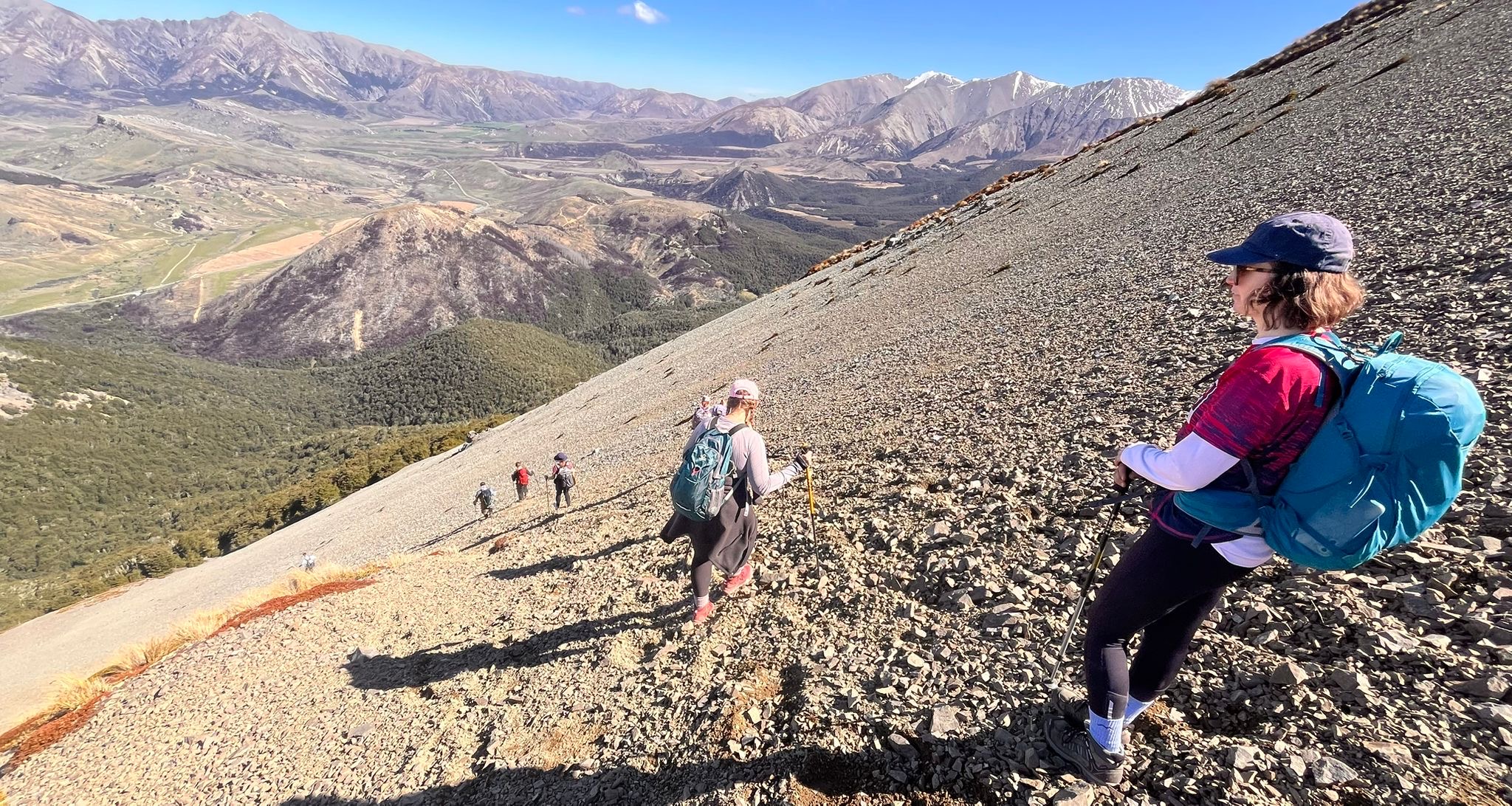
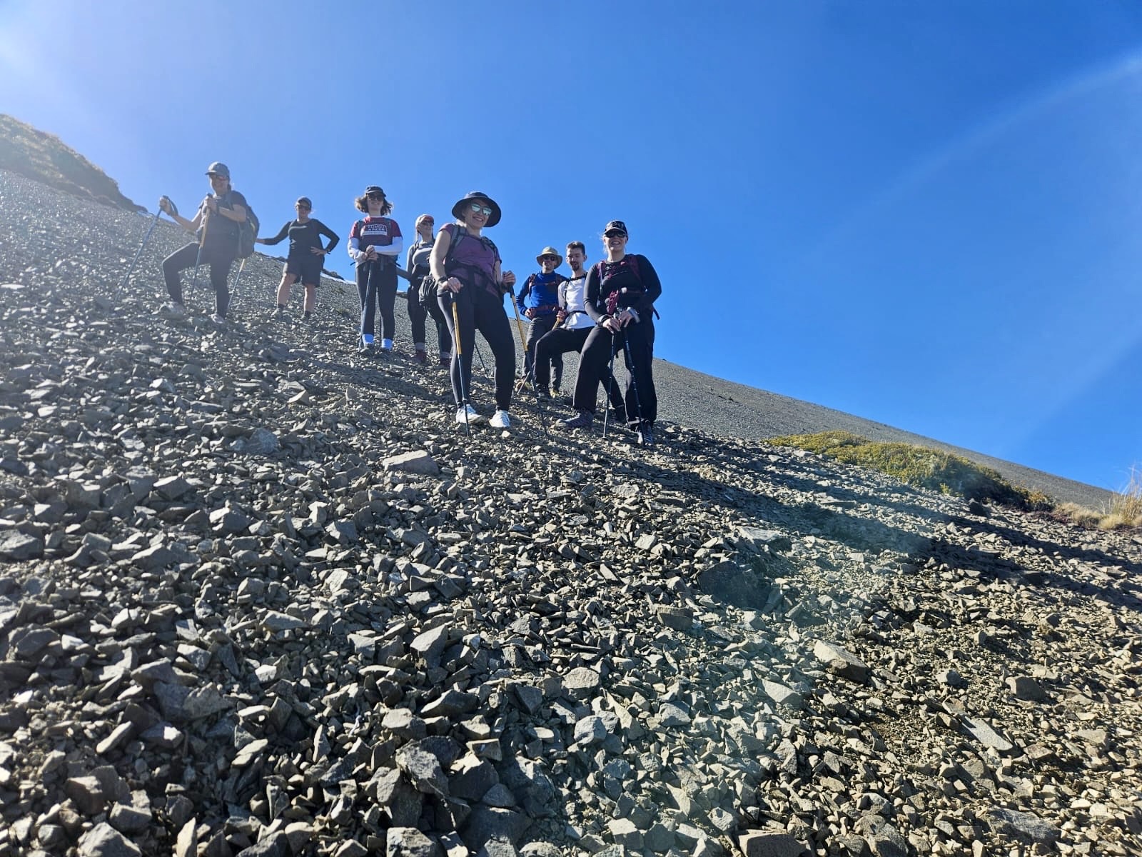
It was November 1, 2025, and the group, comprised of two guides and seven intrepid explorers (myself included), set off to enjoy the Camp Saddle to Lyndon Saddle Loop in Craigieburn Forest Park in the middle of New Zealand’s South Island. This was a chance for the guides to test the group’s mettle, and it was the hike where I discovered that walking on an incline on the treadmill at Orangetheory will never compare to the real thing.
The Ascent
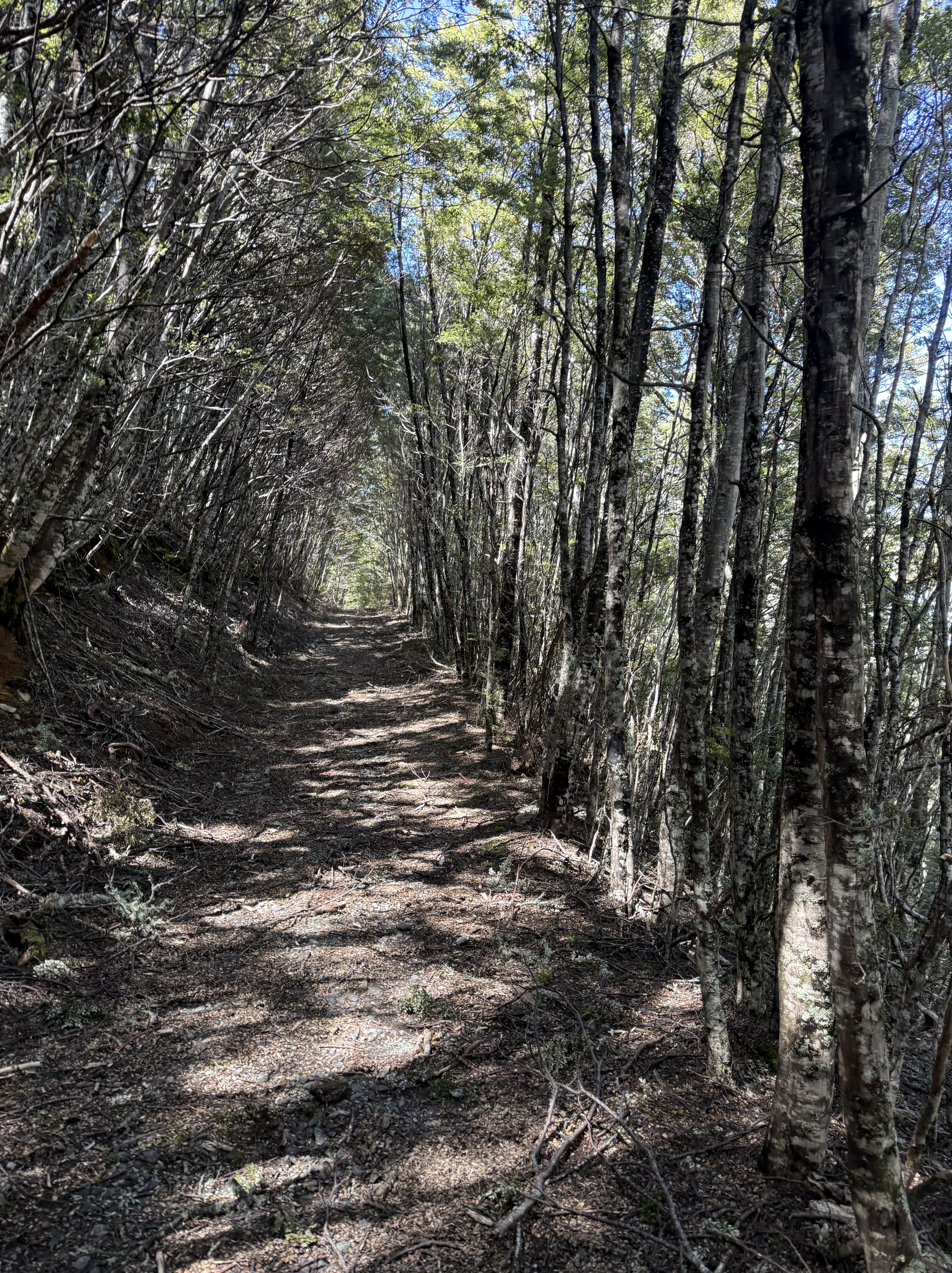
New Zealand’s Department of Conservation describes the route as an advanced tramping track. Now, I thought I was an experienced hiker going into this trip. I really did. And the beginning of the hike was certainly what I was used to—a paved road with a modest incline that eventually gave way to a dirt trail that required some attention so as not to trip over rocks or roots. Nothing crazy.
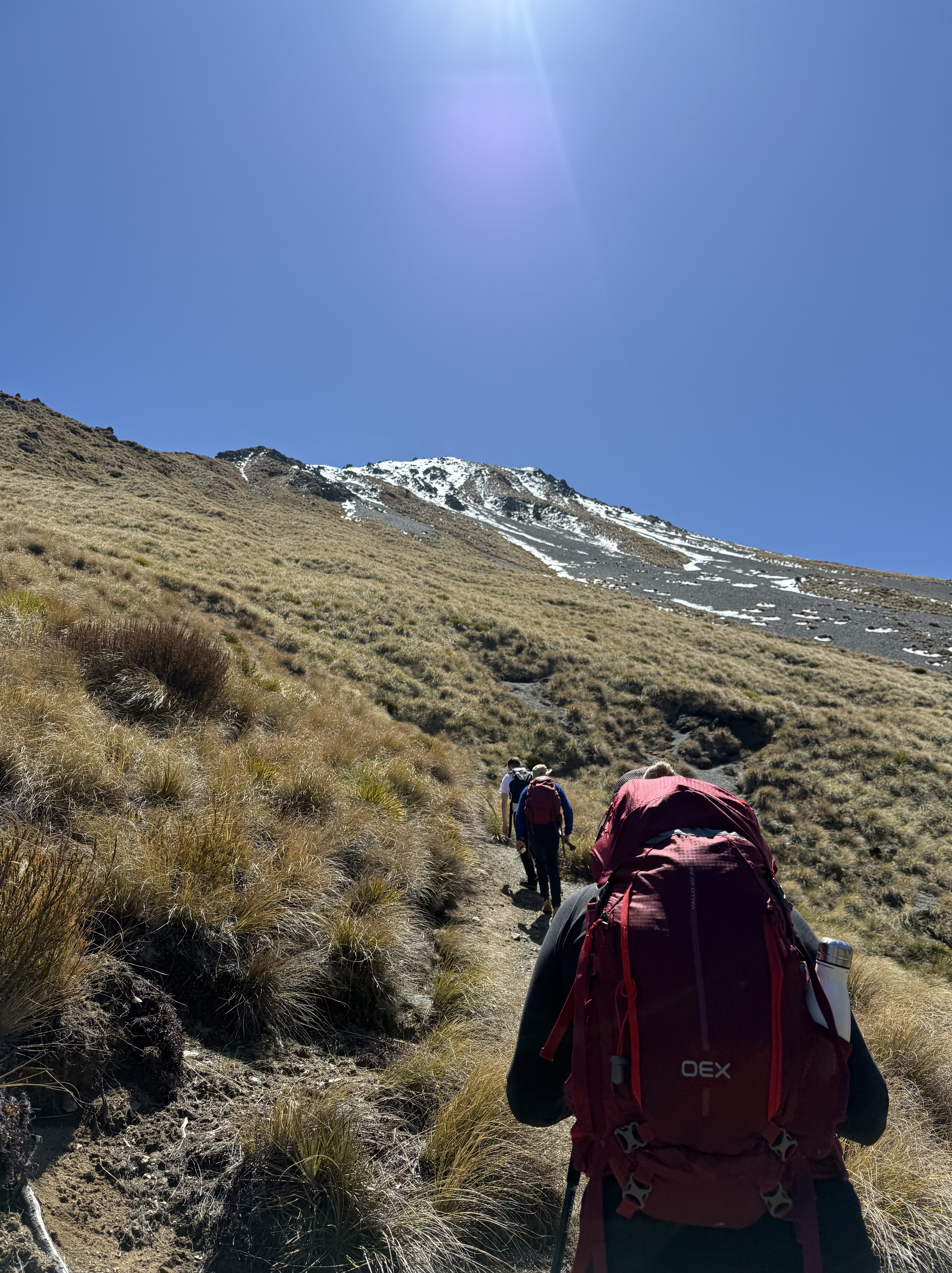
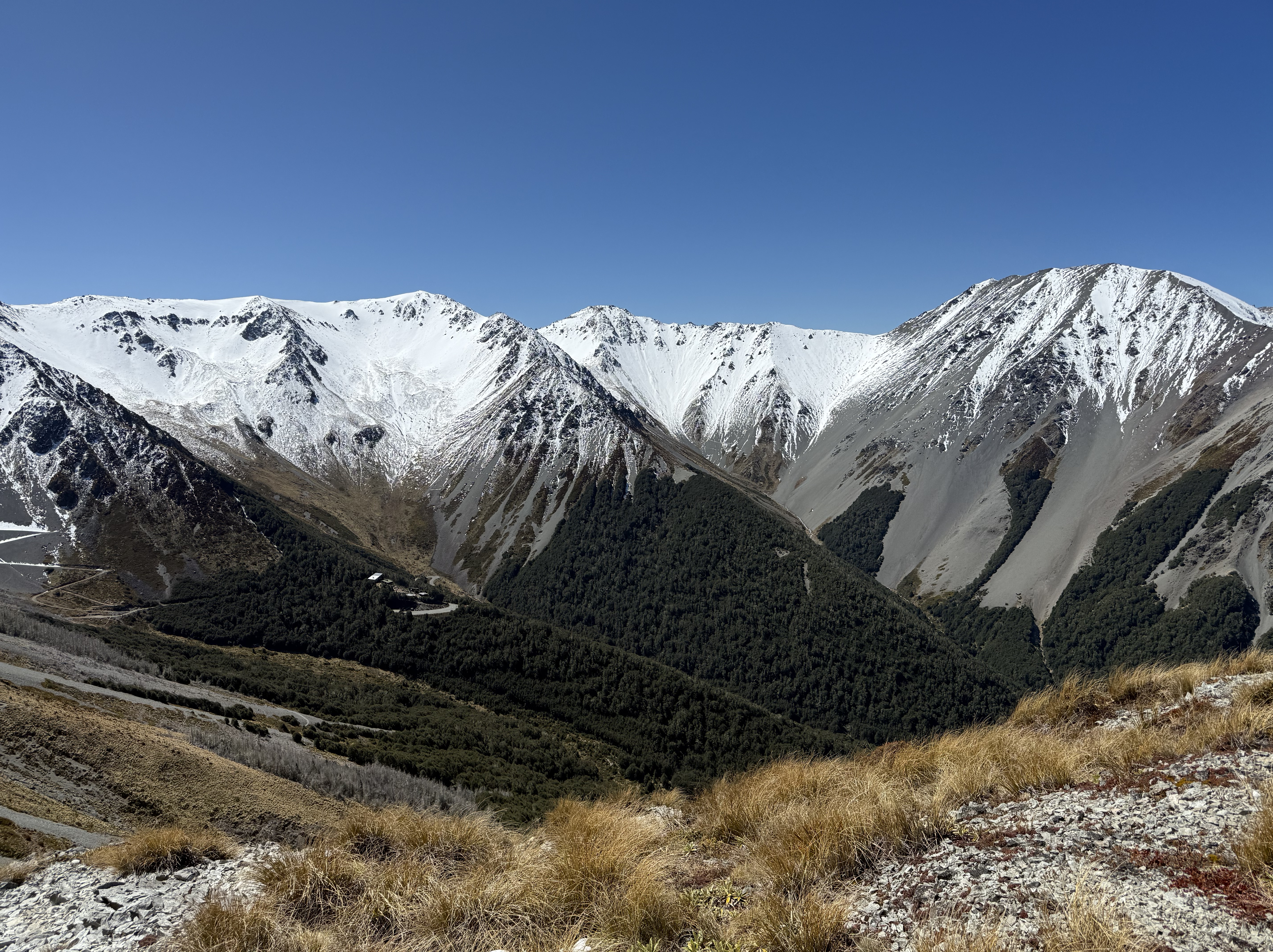
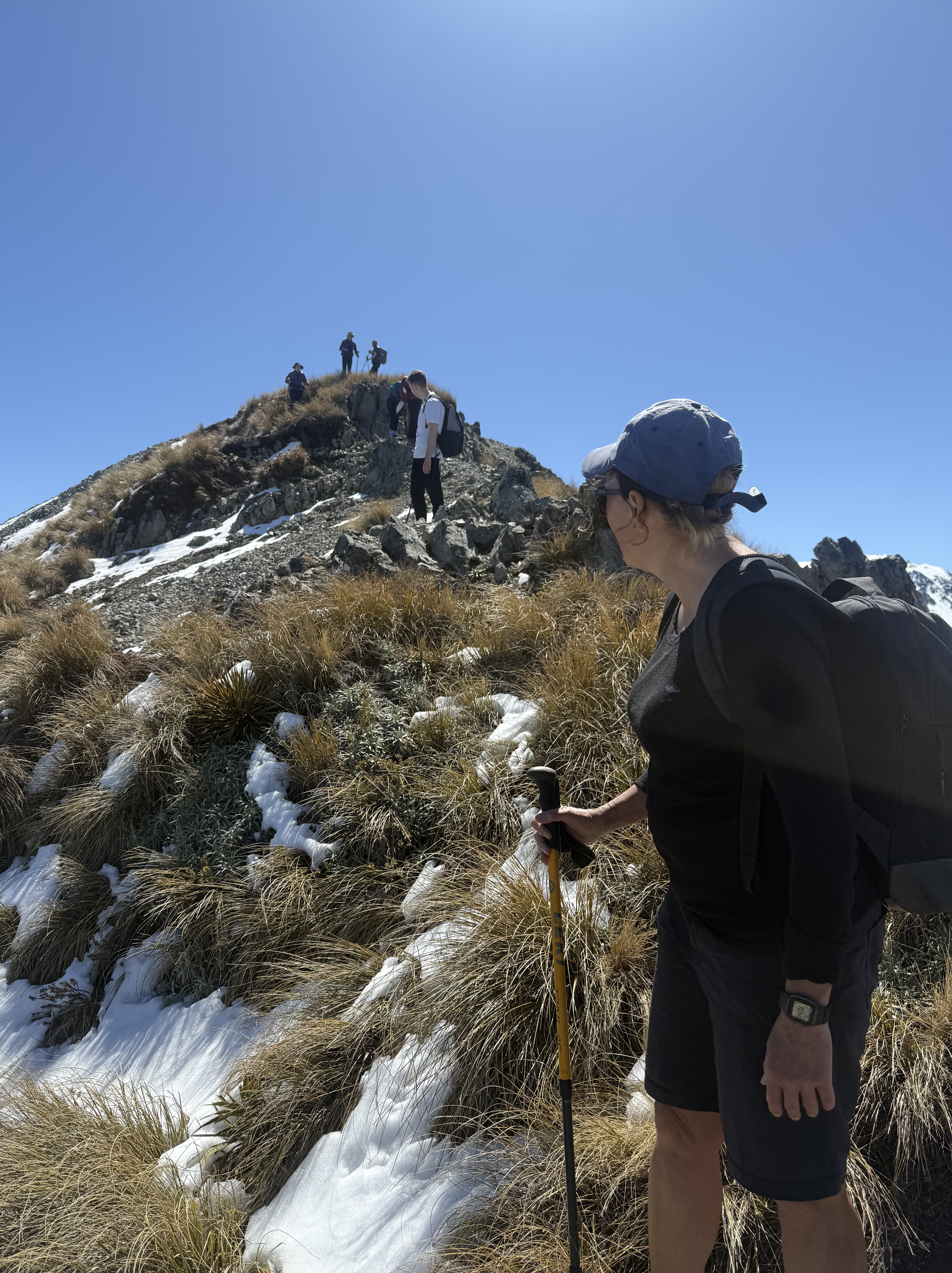
As soon as we moved above the tree-line, however, the hike became something I hadn’t experienced before. The UV in New Zealand is something to be aware of, and without the trees for protection, I was feeling the effects of the sun’s powerful rays. The trail became much more exposed as we made our way up the mountain to the saddle. Snow from the prior week added to the fun. While it was mostly melted, I had to be careful with my footing so I didn’t slip. I didn’t want to be the idiot American who fell off the mountain the first day of the trip.
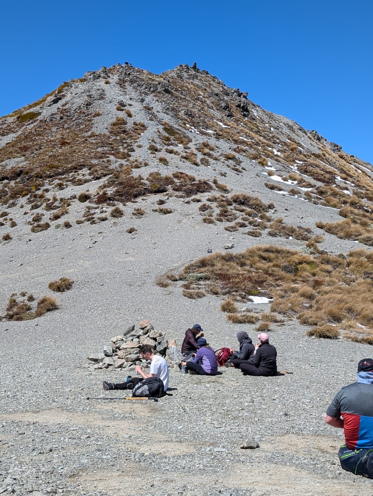
Best I can tell from what I’ve been able to find online, we ascended 1,634 feet (~498 meters), where we rested and enjoyed lunch. I needed that break; that’s for sure. On the ascent, I was gasping for air. The Camp Saddle sits at an altitude of 4,888 feet (1,490 meters)—no big deal for someone who regularly climbs or hikes mountains. But if you recall, I live at around 580 feet in a decently humid climate. The higher altitude also leads to drier air, and I was feeling those effects. (Later in the hike, I needed to borrow some water from one of our wonderful guides, even though I set out with a full 64 oz. bottle.)
The Descent
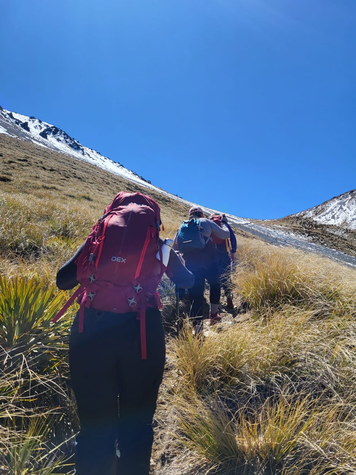
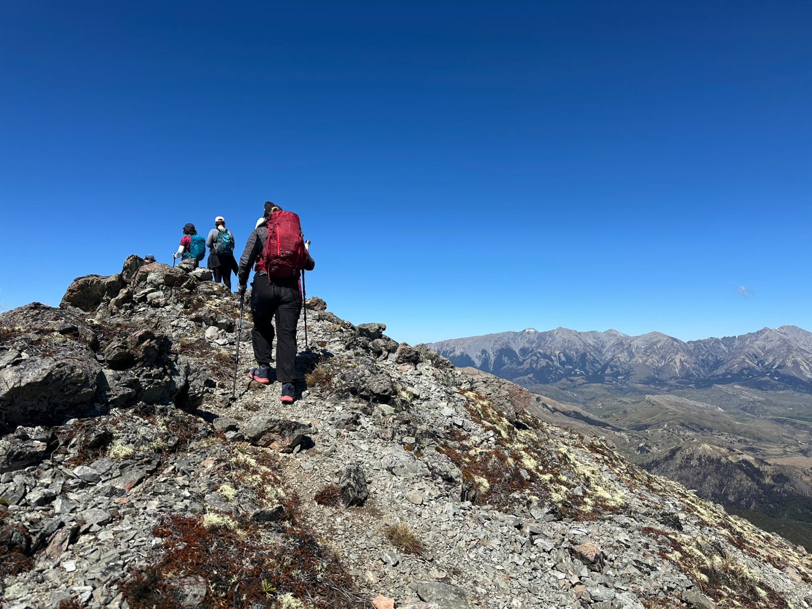
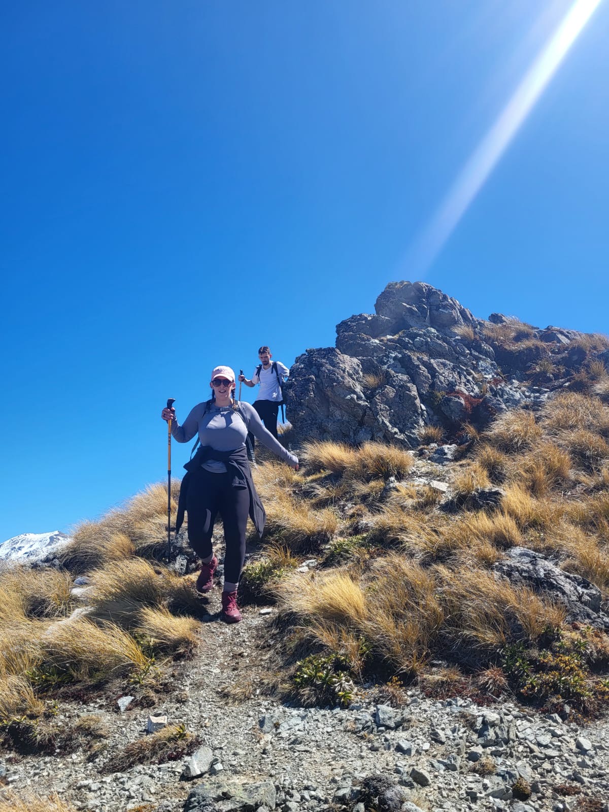
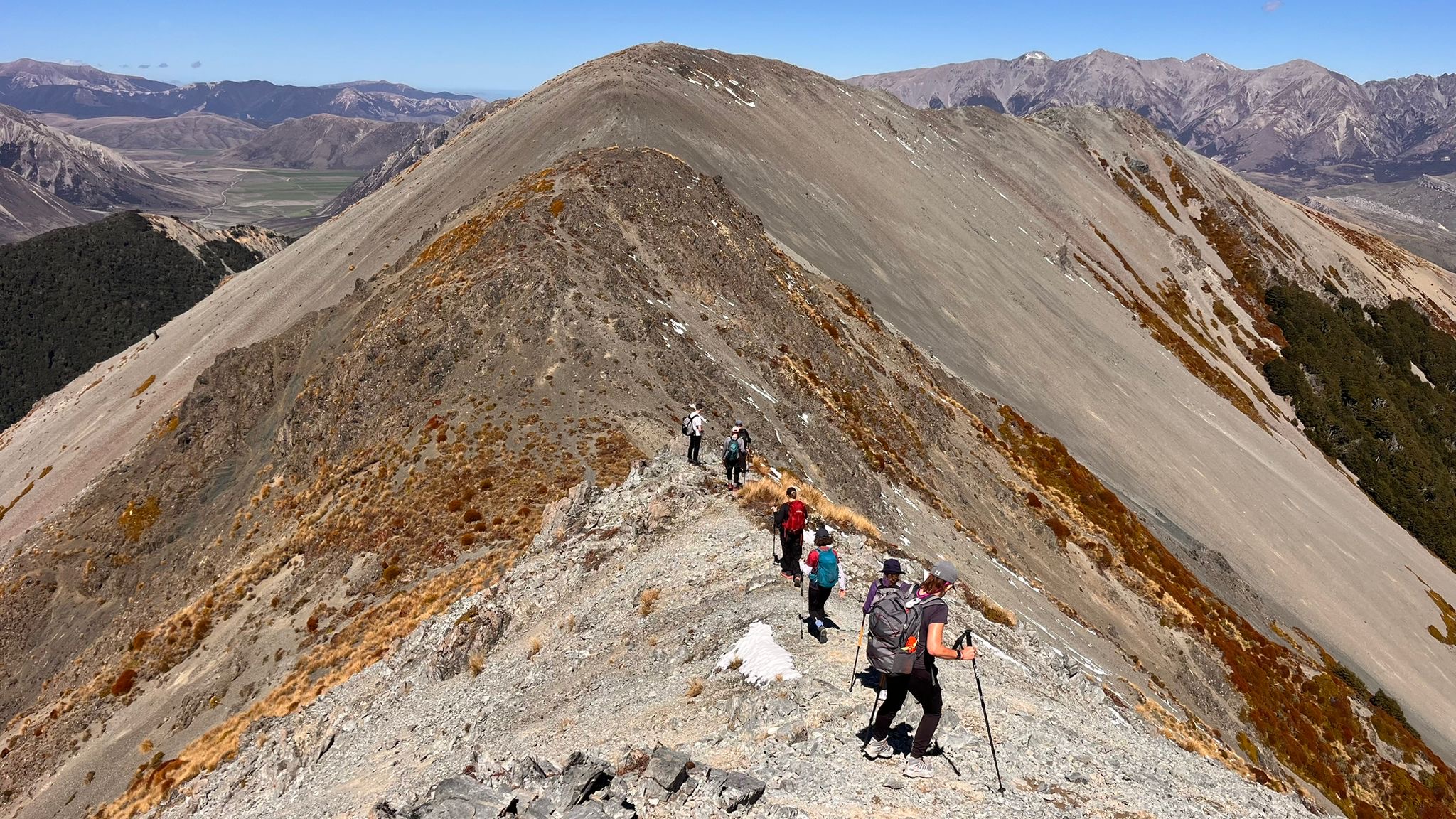
After that much-needed rest, we left the Camp Saddle to make the unmarked journey to the Lyndon Saddle track. We climbed even higher, at points doing some light scrambling along a ridge. That part was pretty fun and made for some good photos.
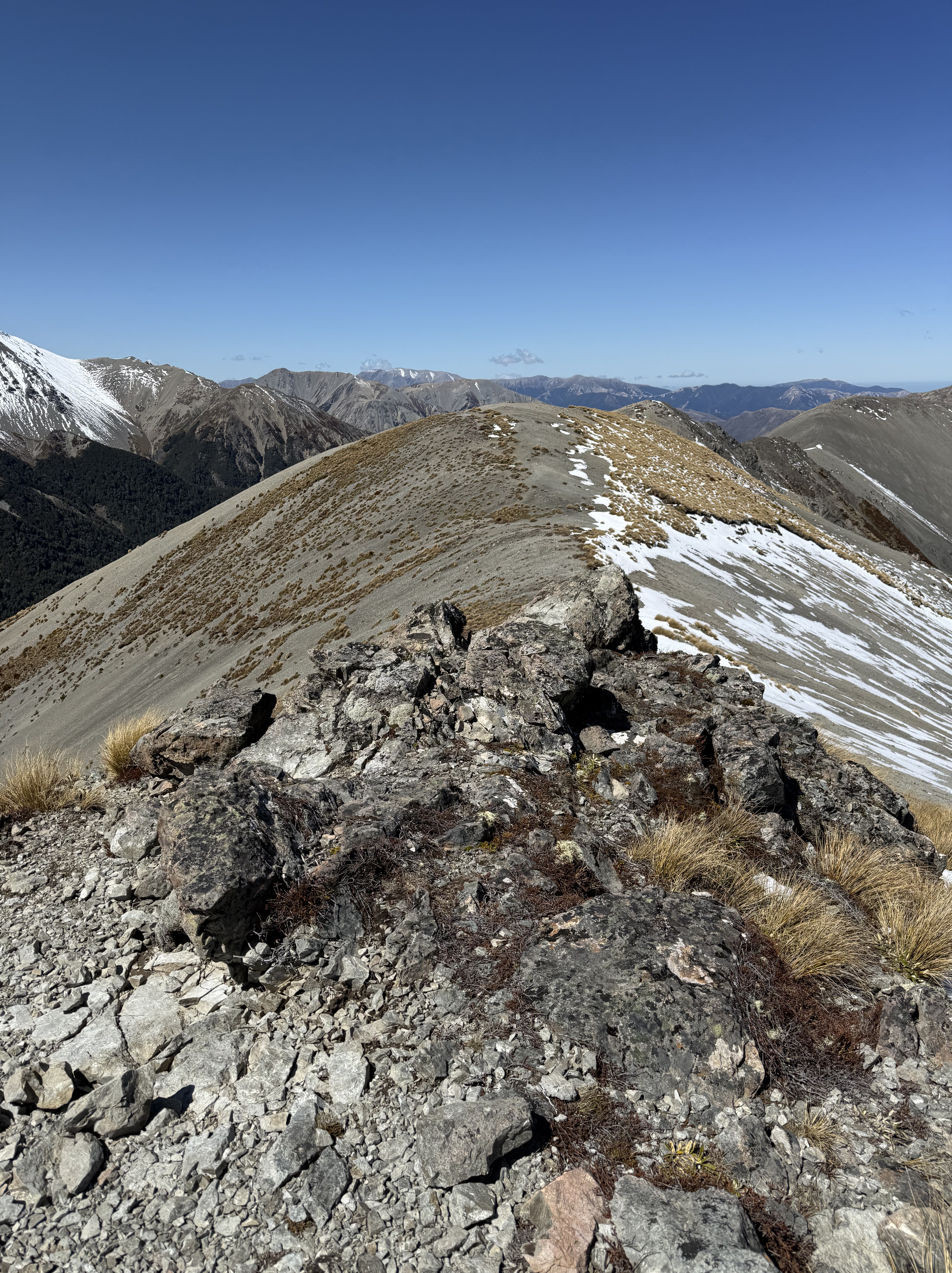
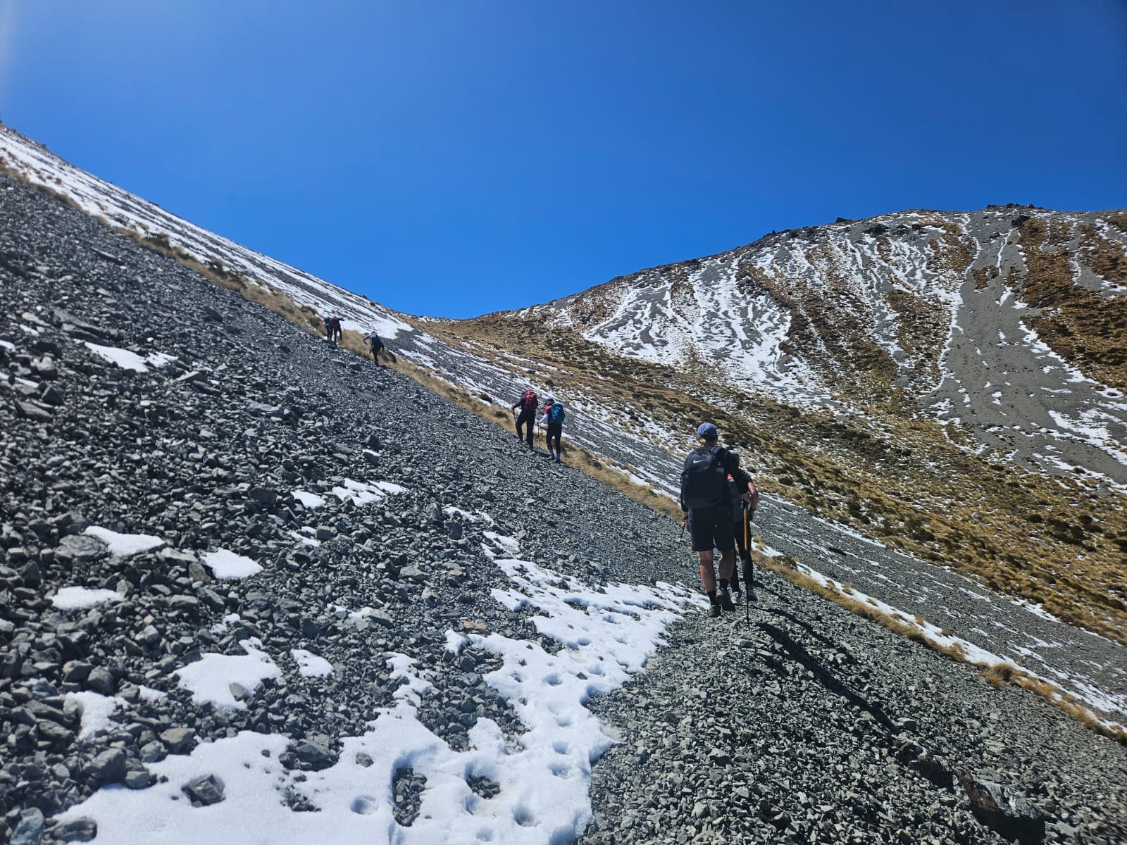
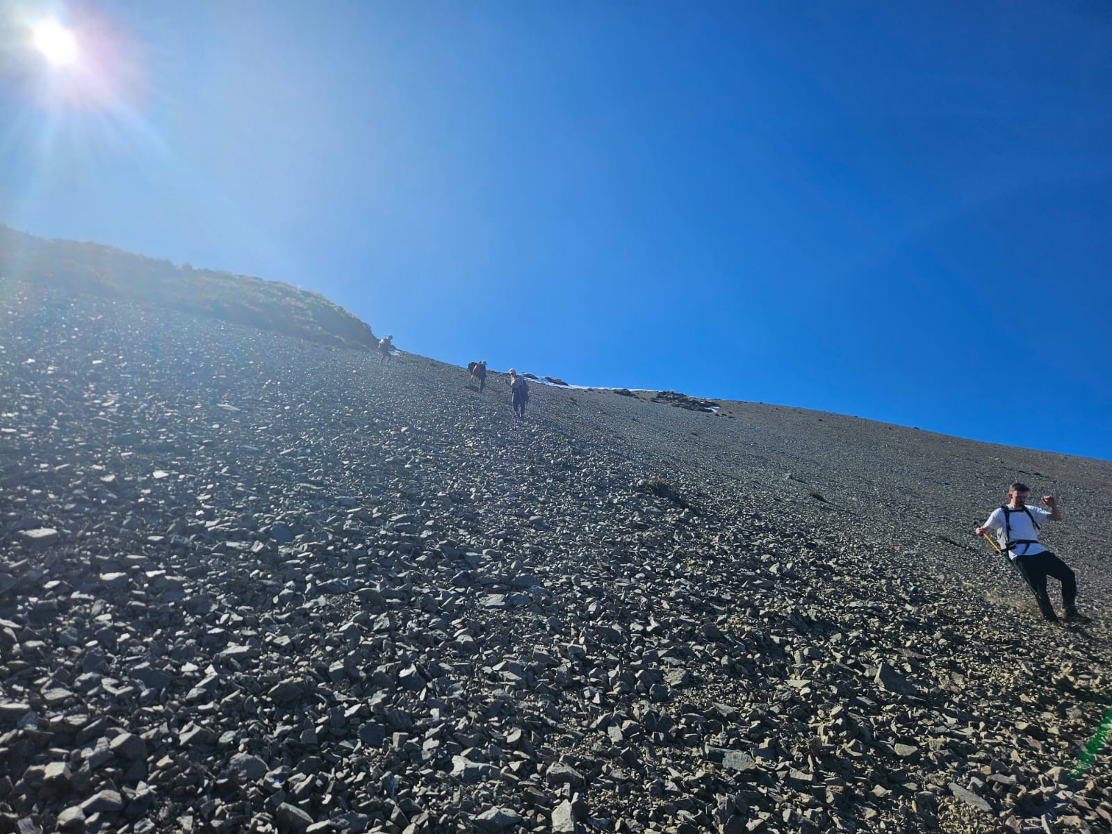
Eventually, though, the ridge came to a defined ending, at which point I found myself looking down a steep slope made up of loose rocks (scree). “We’re doing down that?” I asked.
Indeed we were.
The DOC site perfectly outlines this entire part of the journey:
“From Camp Saddle, trampers can navigate themselves to Lyndon Saddle by continuing southeast along the well-defined ridge. After an hour, descend steeply down a scree slope. Stay on the left of the scree to join an unmarked track through the beech forest to Lyndon Saddle. It is much easier to go down scree than scramble up it, so this trip is better done as a descent.”
Honestly, I can’t imagine climbing up this slope, so it was much better to scramble down instead. We were instructed to lean back and move through the scree as though we were moving down an escalator. Easier said than done. I fought gravity for a while, moving sideways down the first half of the slope and thanking my lucky stars for boots with ankle support and hiking poles. Eventually, though, I relaxed and got my body moving in the recommended way.
At the bottom of the slope, we took a quick rest before making our way through the beech forest the DOC site mentioned. I was questioning my life choices as I was pushing tree branches out of my face and trying not to fall down any unseen drops in the terrain.
Eventually, though, we were back on a dirt trail and I could move more freely again.
What I Learned
At the end of the hike, I was a little shaky and had fleeting thoughts of doubt about what I’d gotten myself into with this trip. But mostly I was grateful for having been able to get through everything unscathed—and to chug some water and a sugary beverage.
This was only the first hike of the trip. A more daunting hike loomed on the horizon. As you can imagine, my mind was all over the place. But the newly forming camaraderie amongst the group, the breathtaking sights all around me, and the fact that I was finally in New Zealand after years of dreaming about it—that was all enough to override any real doubts.
On this hike, I learned that I need to hydrate more before the start. I was worried about having to take too many pee breaks on the trail, which turned out not to be an issue. Between physical exertion and the drier air, I was fine. I started carrying two bottles of water with me at all times and took every opportunity to top off my large water bottle.
I also learned that altitude does have an effect. This is certainly something I knew, but I knew it in the way that I know the moon is 238,855 miles from Earth. Experiencing it for myself gave me a different sense of knowing.
What I’m Doing Now
Now, with my next trip to several U.S. National Parks out west just a few months away, I know this experience didn’t put me off hiking. My coast-to-coast NZ trip was challenging, no doubt. In fact, the travel company re-graded the difficulty ratings of its trips and this one went from a 3 to a 4, which explains a lot. A level 4 trip is “Moderate-Challenging: Most days on this trip are of moderate difficulty, while other days will test your endurance and determination and be more akin to a Challenging level trip.” Yep. My trip in September, by comparison, is only a level 2, which is “Easy-Moderate: A good general level of fitness is recommended, as you’ll be spending up to five hours per day walking on mountain trails—some of which involve moderate elevation gains.”
Even though my next trip will be easier (in theory), I’m training harder. I can’t account for the altitude in Chicago. I just can’t. I’ll be traveling to Grand Cayman at the end of July, and that won’t help me altitude-wise, either. But I’m hitting higher inclines than ever before on the treadmill at Orangetheory and lifting heavier, too.
At some point as I was researching the altitude and elevation gain of the trek I’ve recounted here, I saw that the trail incline hit a 13% grade. While that’s far from the most intense grade one can encounter on a mountain, that number has been stuck in my head and I’ve been hitting the 13% incline on the treadmill during every workout. I also purchased a 20 lb. weighted vest that I will begin incorporating into walks this month to mimic carrying a heavy day-pack.
On top of all this, I’ve also been losing weight again. My weight had been creeping up a bit ahead of my New Zealand trip, and while it wasn’t out of control, the modest gain beforehand didn’t help me.
Time will tell if my more focused training will make tackling the trails of Zion, the Grand Canyon, and Yosemite easier, physically. What I do know is that I’ll be heading into that trip with more knowledge and experience than I had when I set out on the Camp Saddle track last November.
